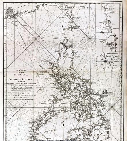
A Chart of the China Sea and the Philippine Islands with the Archipelagos of Felicia and Soloo was prepared on the basis of the chart of Philippine archipelago watercourses compiled in 1734 by the Jesuit Pedro Murillo de Velarde, and new data from the British Maritime Survey. In the map, not only the English names of the three shoals, but also their names in the chart of waterways in the Philippine Islands were marked. The shoal in the north was marked Galit, that in the middle Panacot and that in the south Lumbay. Beside Scarborough Shoal (ie, Huangyan Dao), there is the annotation "The Scarborough Sept. 12th, 1748", indicating that the tea-carrying British ship Scarborough struck the shoals and sank on September 12, 1748. In this map, Panacot Shoal and Scarborough Shoal (Huangyan Dao) were both marked, indicating that the two were totally unrelated.

A Chart of the China Sea and the Philippine Islands with the Archipelagos of Felicia and Soloo


