It can be seen in the French Map of Tsiompa, Cochin China, Tokyo Bay, China and Philippine Islands that the marks for the nine islets were not original, but were scribed later on in brown in the corresponding locations. This shows that neither the people of Annam nor the French were clear about the exact locations of the nine islets. The brown marks were added by the Far East Institute of France, after France occupied them. Therefore, the claim of the French government in 1930 about the so-called "Vorhabe right" to the Nansha Qundao for Annam could not be sustained. The added names of the nine islets on the map reflected the fact that the French had forcefully occupied those islands.
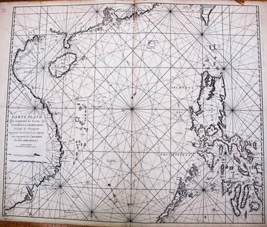
Coastal Map of Tsiompa, Cochin China, Tokyo Bay, China and Philippine Islands
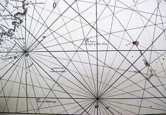
Close-up View of the Nine Islets Marked by French in Brown


