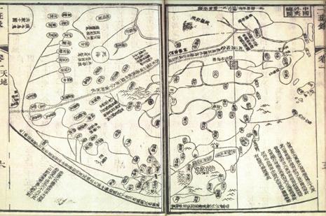
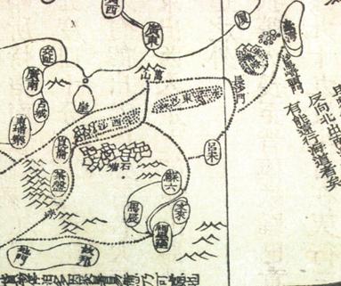
Compiled and printed by Zheng Guangzu in 1839 (the nineteenth year of Daoguang in the Qing Dynasty), Yi Ban Lu had as its appendix "General Map of China and Overseas Countries", in which navigation routes to "Dongsha", "Xisha" and "Shitang" of the South China Sea were marked. Among those, "Dongsha", "Xisha" and "Shitang" refer to Dongsha Qundao, Xisha Qundao and Zhongsha Qundao, and Nansha Qundao, respectively. This is the first time for "Xisha" to be used in reference to Xisha Qundao in maps created in the Qing Dynasty.

"General Map of China and Overseas Countries"

Close-up View of General Map of China and Overseas Countries


