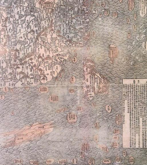
In 1767 (the thirty-second year of Qianlong in the Qing Dynasty), the famous poet Huang Qianren (alias Zhengsun) re-engraved the map created by his grandfather Huang Zongxi the great thinker and renamed it to Da Qing Wan Nian Yi Tong Tia Xia Quan Tu. In the map, the coastal navigation routes were marked in detail, and the South China Sea area was marked "Nan'aoqi", "Wanli Changsha" and "Wanli Shitang," which refer to Dongsha Qundao, Zhongsha Qundao and Xisha Qundao, and Nansha Qundao, respectively.

Close-up View of Da Qing Wan Nian Yi Tong Tian Xia Quan Tu


