Dongsha Qundao
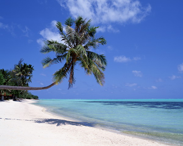
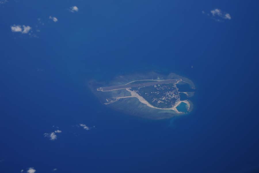
The northernmost of the four archipelagos in Nanhai Zhudao, Dongsha Qundao is located at latitude 20°42'N, longitude 116°43'E, about 260 kilometers to Shantou City in the north and about 315 kilometers to Zhujiang River estuary in the northwest. According to Standard Names for Part of the Islands in Nanhai Zhudao released by the National Committee for Geographical Names in 1983 under authorization, Dongsha Qundao mainly consists of Dongsha Dao, Dongsha Jiao, Beiwei Tan, Nanwei Tan and other natural terrains. The reef base of Dongsha Dao is crescent-shaped, and thus is also known as Yueya Dao (meaning "crescent island") among fishermen of Chaozhou, Shantou and Jieyang. Covering an area of 1.8 square kilometers and with an average elevation of about 6 meters, it is resultant from accumulation of coral-based biological debris. Dongsha Jiao is an atoll, with outlets on both sides. The resultant two waterways, one deep and wide and the other shallow and narrow, are located in the north and south respectively. Located in the upward section of the continental slope in the northern part of the South China Sea, Dongsha Qundao rose from a platform 300 meters below surface. Dotted with underwater reefs, its waters are dangerous and unfavorable for navigation. Its lush vegetation mainly consists of coconut trees. Its tropical marine climate with hot and humid winds and its situation on the path of typhoons from the western Pacific and the South China Sea have awarded it great significance for weather forecasting. The meteorological station, lighthouse and typhoon observation station on the island were first built in the 1920s and an airport was built on reclaimed land in the 1960s.
Xisha Qundao
Centered on Yongxing Dao and located over 330 kilometers from both Yulin Port of Sanya City and Qinglan Port of Wenchang County, Xisha Qundao is located to the southeast of Hainan Island, under the administrative jurisdiction of Sansha, Hainan Province. Its area of more than 500,000 square kilometers is mainly divided between two island groups, namely Xuande Qundao in the east and Yongle Qundao in the west. According to Standard Names for Part of the Islands in Nanhai Zhudao released by the National Committee for Geographical Names in 1983, a total of 52 names are given to islands and reefs in Xisha Qundao, including nearly 50 for reefs, islands, banks and other natural terrains. Among the four archipelagos of the South China Sea, Xisha Qundao boasts the largest land area above water, covering about 10 square kilometers across 22 islands, 7 sandbanks and other natural terrains. Yongxing Dao, the largest among them all, is the administrative, traffic and economic center of Sansha City. Covering an area of 2.1 square kilometers, its highest is Shidao Dao, measuring 13 meters in altitude. The remnant part of the island is below 9 meters, mostly 1 to 5 meters above sea level. Gaojian Rock (aka. Pyramid Rock) is a volcanic island above water.
Located in the center of the tropics, Xisha Qundao boasts tropical monsoon climate, hot and humid, but without scorching summers. Take Yongxing Dao for example. Its extreme high temperature, extreme low temperature and annual average temperature stand at 34.9℃, 15.3℃ and 26.5℃ respectively, and annual rainfall at 1,505 millimeters. Xisha Qundao is most vulnerable to typhoons. It is one of the famous fisheries in China. Its wide waters dotted with reefs are rich in seafood, including many valuable species, attracting hordes of fishermen every year.
Zhongsha Qundao
Named for its location in the center of Nanhai Zhudao, Zhongsha Qundao lies about 220 kilometers away from Yongxing Dao of Xisha Qundao and over 570 kilometers from Yulin Harbor, Hainan Island in the northwest. According to Standard Names for Part of the Islands in Nanhai Zhudao released by the National Committee for Geographical Names in 1983 under authorization, Zhongsha Qundao is mainly comprised of Huangyan Dao and more than 30 reefs, submerged banks and other natural terrains.
With most of its waters located in the middle of the tropics, Zhongsha Qundao has been one of the birthplaces of tropical cyclones. Its clear water, varying between 25℃ and 28℃ in temperature, is suitable for the proliferation of all types of marine life. Therefore, its fishing grounds are known for sea cucumbers, lobsters and other varieties of seafood, and the yields are extremely high. The period from January to April each year is the main fishing season here.
Nansha Qundao
As the southernmost archipelago with the most numerous reefs, islands and beaches distributed over the widest area in Nanhai Zhudao, Nansha Qundao adjoins Vietnam in the Northwest, and Indonesia, Malaysia, Brunei and other countries in the south and faces the Philippines across the sea. The central island Taiping Dao is situated 750 kilometers from Yongxing Dao of Xisha Qundao in the north. According to Standard Names for Part of the Islands in Nanhai Zhudao released by the National Committee for Geographical Names in 1983 under authorization, Nansha Qundao mainly consists of 6 reef groups, nearly 200 islands, reefs, beaches, sandbars and other natural terrains.
Nansha Qundao is located in the low-latitude tropics of the northern hemisphere, close to the equator in the south, with high temperatures all year round. There is but one season and that is summer. For example, the temperature of Taiping Dao averages 27.9℃ annually, with limited fluctuations. In the hottest months of April and May, the temperature averages 29℃, and in the coldest month of January, it averages 26.8℃. With an annual rainfall of 1,842 mm, it has a rainy season of 7 months. Compared with the other three archipelagos, Nansha Qundao is less affected by typhoons. The reason is that typhoons rising in the western Pacific to the east of the Philippines and those formed on the waters adjoining Xisha Qundao and Zhongsha Qundao generally move west or northwest, due to attraction by the tropical maritime airflows and influences of the earth's rotation. Therefore, Nansha Qundao is less susceptible to direct attacks by typhoon centers.


