The Period of the Republic of China (1911-1949)
After the Revolution of 1911, Guangdong Provincial Government declared that Xisha Qundao be put under the jurisdiction of Yaxian County (today's Sanya City) of Hainan Island.
In December 1914, in the chart of the New Geographical Charts of the Republic of China published by Shanghai Yadong Library, the Chart of China's Territory before the Reign of Emperor Qianlong and Emperor Jiaqing of the Qing Dynasty, the peripheries of Dongsha Qundao and Xisha Qundao within the South China Sea Area were marked with scope lines, including Dongsha Qundao and Xisha Qundao into the scope of China's territory.
In 1917, some Chinese businessmen filed an application for collecting phosphorus and marine products in Xisha Qundao to the governor's office of Guangdong Province, a sketch was attached.
In 1921, the Ministry of the Interior of the government of the Republic of China approved He Ruinian, a businessman from Guangdong Province, to set up industries such as fishery, aquaculture and mining on Xisha Qundao. Later it was found out that He Ruinian had gone so far as transferring his right of operation to some Japanese businessmen, thus his right of operation was canceled.
On August 22, 1921, Aristide Briand, French prime minister and foreign minister said, "since the Chinese government had asserted its sovereignty in 1909 (refers to Li Zhun's inspection tour over Xisha Qundao), it is impossible for us to assert claims over these islands (Xisha Qundao)".
In November 1927, the Surveying Bureau of Guangdong Army of the Republic of China drew the maps of Xisha Qundao.
In May 1928, the Guangdong Provincial Government of the Republic of China dispatched a survey team consisting of military officer, government officials and technological experts to carry out field surveys of Xisha Qundao by taking the "Hai Rui" ship. And the team was required to submit a detailed survey report.
In the year of 1929, the French colonial authority instructed its officials to collect various materials, attempting to cobble up some so-called historical evidences to invade China's Xisha Qundao and got nothing. Therefore, the acting viceroy of France in Indochina had to admit that, "according to reports from various sources, the Paracel Islands (i.e. Xisha Qundao) shall be deemed as belonging to China."
On January 2, 1930, the UK and the US signed the Treaty on the Demarcation of border between the British North Borneo and US Philippines (i.e. the US-UK Treaty). The North Borneo was located on the northeast of Borneo Island, i.e. today's Sabah of eastern Malaysia, and Nansha Qundao was to the north of it. So, this treaty has nothing to do with the ownership of Nansha Qundao.
In April 1930, the Meteorological Conference of the Far East, which was held in Hong Kong and participated by representatives from China, France, the Philippines and the China's Hong Kong Authorities, had passed a resolution requesting the Chinese Government to set up a meteorological observatory on Xisha Qundao. None of the participating representatives raised any objection.
On April 13, 1930, the French invaders sent the Mauricio gunboat to invade China's Nanwei Dao.
On December 4, 1931, taking advantage of the occasion when Japan was invading the northeast of China, the French government sent a note to the Chinese legation in France, claiming that Annam (old name for Vietnam) had the so-called "Vorhabe right" over Xisha Qundao, brazenly raising territorial claims over these islands.
On July 26, 1932, the Chinese Government presented a note to the Foreign Ministry of France and rejecting the French Government's territorial claims over Xisha Qundao by pointing out that Xisha Qundao had long been under the jurisdiction of China.
On November 30, 1932, Zhu Zhaoshen, an inspection commissioner of Foreign Ministry of the Chinese Government had solemnly pointed out in his official letter to the consul of French Consulate in Guangzhou that, "it is indeed without a doubt that Xisha Qundao is part of China's territory".
In April 1933, France occupied the islets near the Nanwei Dao of the China's Nansha Qundao. Yet at that time, France did not announce the news of its occupying of Nansha Qundao and Reefs immediately.
On June 7, 1933, The National Committee for the Examination of the Land and Sea Maps, which was composed of representatives of the Ministry of Foreign Affairs, Ministry of the Interior, Ministry of the Navy and other institutions of the Republic of China, reviewed and approved the names of individual islands, reefs, shoals and cays of China's Nanhai Zhudao.
On July 25, 1933, France announced its occupation of the 9 islands of Nansha Qundao (including Nanwei Dao, Taiping Dao, Zhongye Dao, Nanyao Dao, Beizi Dao, Nanzi Dao, Hongxiu Dao, Anbo Shazhou and Yangxin Shazhou) taking "they were ownerless lands" as an excuse. This is the "Incident of France's Occupation of the Nine Islets". However, when the French ships landed on the Dao, there were already Chinese fishermen living on the Dao and Chinese slogans could be found on the Dao.
On July 26, 1933, the spokesperson for the Ministry of Foreign Affairs of the Republic of China made a statement, "on the coral Islands between the Philippines and Annam, there were just Chinese fishermen living there. Thus they are regarded as China's territory in the international community. Yet we are so surprised to know from some official reports of the French side just now, that France has officially announced its occupation of them. What kind of basis do they have to make such an announcement? The French government hasn't published its reason. So the Ministry of Foreign Affairs has called our Embassy in France to inquire about the actual situation. Besides, currently, both the Ministry of Foreign Affairs and the Ministry of the Navy are proactively working on ways of coping with this situation, and have lodged a strong protest against such act of the French government."
In January 1935, The National Committee for the Examination of the Land and Sea Maps, which was composed of representatives of the Ministry of Foreign Affairs, Ministry of the Interior, Ministry of the Navy and other institutions of the Republic of China, reviewed, approved, and published the Chinese and English Places Names Table of the Islands in the South China Sea, which included names for 132 Islands and reefs (among them, 29 were in Xisha Qundao, 96 were in Nansha Qundao).
In April 1935, the Navy Hydrographic Bureau of the Republic of China completed the field surveying of Nanhai Zhudao, and The National Committee for the Examination of the Land and Sea Maps reviewed and published Zhong Guo Nan Hai Ge Dao Yu Tu (Map of the South China Sea Islands of China), clearly indicating the specific names and locations of the 135 islands and reefs of Nanhai Zhudao including Nansha Qundao.
In September 1937, the Japanese invaded China's Dongsha Qundao.
From November 1938 to March 1939, the Japanese invaded China's Xisha Qundao.
On March 30, 1939, the Japanese expelled the stay-behind personnel of France, and occupied Tuansha Qundao (i.e. Nansha Qundao).
On April 9, 1939, Japan announced its occupation of 3 Islands including the Tuansha Qundao, and changed the name of Tuansha Qundao into "Xinnan Qundao". The Office of Governor-general of Taiwan declared with the No.122 official notice that it had jurisdiction over the "Xinnan Qundao", together with Xisha Qundao and Dongsha Qundao. And it was incorporated into Gaoxiong City.
In December 1943, China, the US and the UK issued the Cairo Declaration. It was provided that Japan should return the Chinese territory including Nanhai Zhudao and the provision went as follow, "all the Islands that Japan acquired or occupied in the Pacific since the outbreak of the First World War in 1914 be restored to the countries that originally own them, and all the territories Japan had stolen from the Chinese, such as Manchu, Taiwan, and Penghu Islands shall be restored to China". Nanhai Zhudao was occupied by Japan during the Japanese War of Aggression against China. According to the provision of Cairo Declaration, they should of course be returned to China.
On July 26, 1945, China, the United States and the United Kingdom issued the Potsdam Proclamation that urged Japan to surrender. That Proclamation emphasized that "the terms of the Cairo Declaration shall be carried out. And the sovereignty of Japan shall be limited to Honshu, Hokkaido, Kyushu, Shikoku and other islets determined by the three of us".
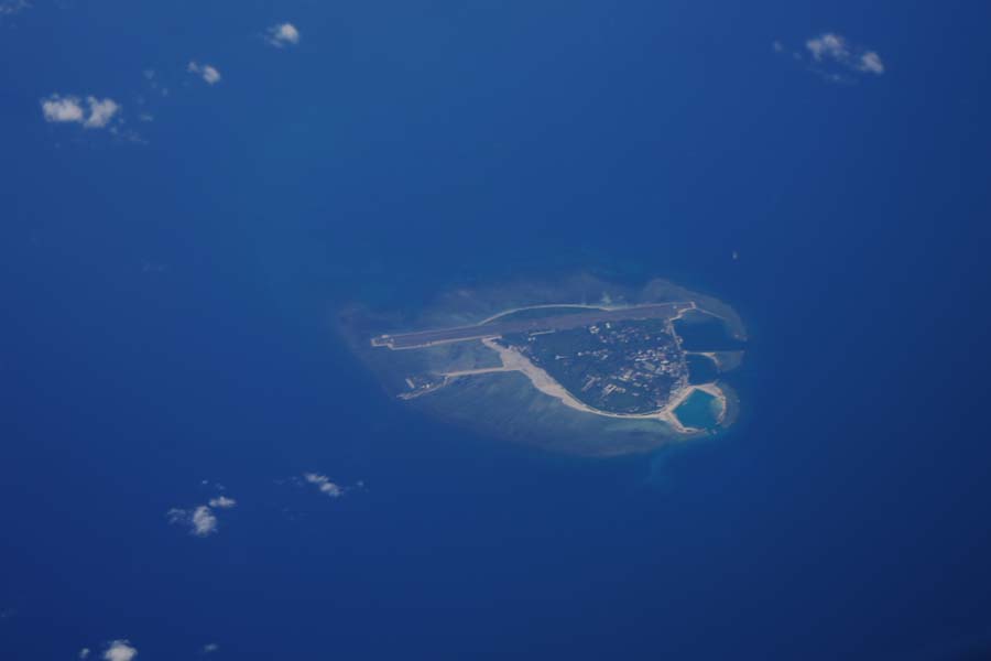
On November 24, 1946, the two warships to take over Xisha Qundao, namely Yongxing Ship and Zhongjian Ship, which were led by Yao Ruyu, arrived at the Wude Dao. The name of this Dao was changed to Yongxing Dao in memory of the taking-over warship, the Yongxing Ship. And a monument engraved with Nan Hai Ping Fan (The barrier of the South Sea) was erected to commemorate the Navy's taking over of Xisha Qundao.
On December 12, 1946, the Taiping Destroyer and the Zhongye Tank Landing Ship to take over Nansha Qundao, which were led by the Commander-in-chief Lin Zun, arrived at Changdao Dao, the main Dao of Nansha Qundao. And the name of this Dao was changed to Taiping Dao in memory of the taking-over ship, the Taiping Destroyer. And a stone monument engraved with "Taiping Dao of Nansha Qundao" was erected there. On December 14, a flag-raising ceremony was carried out by the Navy officers and soldiers who had entered and would be stationed on the Dao as well as representatives of different ministries and Guangdong Provincial Government.
On December 1, 1947, the Ministry of the Interior of the Republic of China officially published the Table of Old and New Names of Nanhai Zhudao. In this table, "Nan Hai Ge Dao Yu" was changed to "Nanhai Zhudao". One of the two "Dong Sha Dao" was changed to "Dong Sha Qun Dao (Dongsha Qundao)". Tuan Sha Qun Dao was changed to Nan Sha Qun Dao (Nansha Qundao), and Nan Sha Qun Dao was changed to Zhong Sha Qun Dao (Zhongsha Qundao). 172 place names of Nanhai Zhudao were reviewed and re-approved.
In December 1947, the Nan Hai Zhu Dao Wei Zhi Tu (the Location Map of Nanhai Zhudao) was drew by the Department of Administrative Regions & Borders of the Ministry of Interior, and published by the Survey Bureau of the Ministry of National Defense of the Republic of China.
In February 1948, the Department of Administrative Regions & Borders of the Ministry of Interior of the Republic of China published the Zhong Hua Min Guo Xing Zheng Qu Yu Tu (the Maps of Administrative Regions of the Republic of China) and the Nan Hai Zhu Dao Wei Zhi Tu (the Location Map of Nanhai Zhudao) was attached. In this attached map, the South China Sea dotted line consisting of 11 sections of line was marked out starting from the Beilun Estuary of the China-Vietnam Border in the west, to the northeast of Taiwan in the east. Within the line, Dongsha Qundao, Xisha Qundao, Zhongsha Qundao and Nansha Qundao were all marked out, so did the names of Zengmu Ansha (James Shoal) and the majority of the Islands and reefs. The southernmost of the dotted line was marked at about 4ºN.
On January 21, 1949, the Republic of China officially set up Hainan Special Administrative Region directly under the Executive Yuan. This Special Administrative Region included Hainan Dao, Dongsha Qundao, Xisha Qundao, and Zhongsha Qundao, Nansha Qundao as well as their affiliated Islands and the sea area.
On April 13, 1949, with the No. 2973 official letter, Chen Zhi-ping, the Chinese Minister to the Philippines made representations to the Foreign Ministry of the Philippines on the cabinet council of the Philippine government's decision of dispatching Rear-admiral Jose V. Andrada to "inspect" Taiping Dao of Nansha Qundao and plotting to relocate immigrants there. It was stated that Taiping Dao was China's territory. The Vice Foreign Minister of the Philippines Felino Neri replied by a letter claiming that "the cabinet was just discussing that more protection should be given to the Philippine fishermen who were reportedly conducting activities (editor's note: fishing) in the nearby water areas of the Itu Aba Dao (editor's note: i.e. Taiping Dao)". It was confirmed that the Philippines did not have sovereignty claims over Taiping Dao.


